Drone property documentation
for Lake Norman.
High-resolution aerial photos, video, and dated condition records for storm damage, roofs, construction progress, recurring property inspections, golf course monitoring, and real estate listing media. Independent documentation, no sales agenda.
FAA Part 107
Compliant commercial flights
48-Hour
Digital report turnaround
4K Photo & Video
High-resolution documentation
Independent
No roofing, no inspection, no upsell
Objective documentation. No agenda, no upsell.
We don't sell roofing, home inspections, or insurance adjustments. Our only product is the aerial record, which makes it useful to homeowners, contractors, adjusters, and property managers alike.
Repeatable on a Schedule
Monthly, quarterly, or seasonal flights on a consistent route, so every visit is directly comparable to the last.
Historical Archive You Own
Every flight builds a timestamped record. Compare turf health, roof condition, or site progress month over month, or year over year.
Report-Ready Deliverables
Annotated photos, PDF condition summaries, and organized reports formatted to share with boards, lenders, insurers, and contractors.
Priority Storm Response
Rapid deployment after severe weather, documenting damage before cleanup begins, while your insurance claim is still fresh.
Programs, Not One-Off Shoots
Recurring monitoring programs built around your operational calendar. Predictable scheduling, cumulative records, and pricing that makes sense for ongoing use.
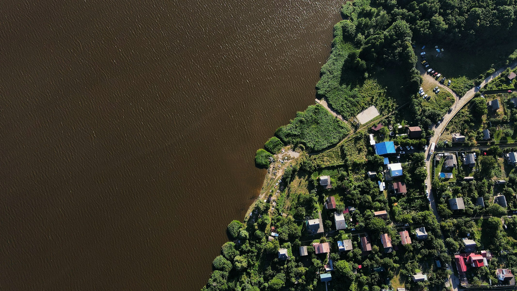
Lake Norman Local
Serving Mooresville, Cornelius, Davidson, Huntersville, Denver, Troutman, Sherrills Ford, and the full Lake Norman area. No travel overhead, fast scheduling.
Recurring programs and one-time reports for Lake Norman properties
Drone property documentation for Lake Norman homes, HOAs, builders, golf courses, and real estate listings. Structured aerial records, not one-off shoots.
Golf Course Condition Monitoring
Aerial condition monitoring for golf courses, country clubs, and superintendents. Document turf stress, irrigation concerns, bunker conditions, storm damage, renovations, and marketing visuals from above.
After a storm, document course damage before cleanup and repairs begin. Priority scheduling within 24 hours of your call.
Recurring Property Inspections
Monthly or quarterly aerial property documentation for HOAs, property managers, and investors. Create a dated visual record of roofs, common areas, drainage, parking lots, exterior conditions, and storm-related changes over time.
Want a visual record before the next storm season? Start with a baseline flight.
Storm, Hail & Damage Documentation
Rapid aerial documentation after storms, hail, wind, fallen trees, or dock damage. Capture time-stamped photos and video before cleanup, repairs, or additional weather changes the scene.
Need documentation after a storm? Request a rapid-response flight before cleanup begins.
Construction Progress Monitoring
Scheduled drone progress flights for builders, contractors, owners, lenders, and investors. Document grading, foundations, framing, roofing, exterior work, and site progress with dated aerial records.
Many owners, lenders, and investors want clear visual progress updates during construction. Aerial documentation supports draw conversations and milestone reviews.
Drone Roof & Exterior Inspection
High-resolution aerial documentation of roofs, gutters, flashing, chimneys, siding, and exterior conditions. Useful for maintenance planning, pre-sale documentation, contractor estimates, and post-storm review.
Documentation is strongest when captured before cleanup, temporary repairs, or weather exposure changes the scene.
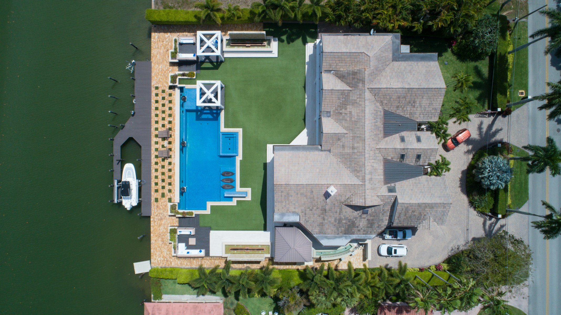
Real Estate Aerial Photography & Video
MLS-ready aerial photos and cinematic drone video for Lake Norman listings. Show lake views, docks, lot size, neighborhood setting, outdoor living spaces, and property scale.
Listings with aerial media perform better on lakefront properties. Book before your listing goes live.
Beyond photography: aerial mapping and 3D modeling
When you need more than photos, our drone mapping services deliver georeferenced aerial maps and photogrammetry-based 3D models built from overlapping high-resolution UAV captures.
Orthomosaic Property Maps
An orthomosaic is a georeferenced, flat aerial map stitched together from dozens of overlapping drone images. Unlike a single overhead photo, it is geometrically corrected, measurable, and can be layered into planning or GIS software.
- Site planning & boundary visualization
- Construction grading and earthwork oversight
- Large estate and multi-parcel documentation
- Shoreline change and erosion tracking over time
- Land surveying support and as-built reference
3D Property Models
Using photogrammetry, we reconstruct a navigable 3D model of your property from overlapping aerial imagery. The output captures roof geometry, terrain elevation, waterfront structures, and exterior features in a shareable, measurable format.
- As-built documentation for new construction
- Volumetric estimates for earthwork and grading
- Detailed roof and structure inspection review
- 3D terrain and elevation modeling
- Shareable models for contractors and engineers
Need a map or 3D model of your property?
Tell us your property address and use case, we'll confirm scope and timeline within 24 hours.
Built for operators, managers, and property professionals
Recurring operational clients. One-time documentation needs. Anyone who needs accurate aerial reporting, from golf courses to individual homeowners.
Golf Courses & Country Clubs
Recurring condition monitoring for turf health, drainage, bunkers, and facility structures. Build a historical aerial record that supports capital planning, insurance claims, and member communications.
Property Managers & HOAs
Maintain a visual inspection record across your managed portfolio, seasonal condition checks, post-storm damage triage, exterior audits, without visiting every property.
Builders & General Contractors
Track grading, framing, and construction progress with scheduled aerial documentation. Give investors and lenders the dated visual records they need without pulling someone off site.
Lakefront Homeowners
Document your roof, dock, shoreline, and exterior for maintenance records, insurance claims, or peace of mind, without hiring multiple contractors just to get eyes on the problem.
Roofers & Exterior Contractors
Capture objective before, during, and after imagery that supports estimates, validates completed work, and gives customers documented proof, reducing disputes and back-and-forth.
Realtors & Real Estate Agents
Give listings a cinematic aerial edge with drone photography that showcases lake views, lot scope, and exterior features. Boost buyer confidence with documentation before listing day.
What your aerial report includes
Every report is delivered digitally within 48 hours of your flight and includes the sections relevant to your use case.
Property Overview
Full aerial view with location context, lot boundaries, and key landmarks annotated
Roof & Exterior Inspection
High-angle drone capture of roof surfaces, gutters, flashing, and exterior envelope with flagged areas
Dock & Shoreline
Aerial and water-level imagery of dock structures, lifts, seawalls, and shoreline conditions
Orthomosaic Map
Georeferenced flat aerial map of the full property stitched from overlapping drone captures
Photo Gallery
Annotated high-resolution stills covering all areas of interest, organized by zone
PDF Summary Report
Written observations, flagged items, before-and-after comparisons, and recommended next steps
Independent documentation for Lake Norman properties.
Independent — No Sales Agenda
We don't sell roofing, home inspections, or insurance services. Our only product is the aerial record, which means your documentation is neutral and useful to every party involved.
FAA Part 107 Compliant
We operate under FAA Part 107 commercial drone regulations. Every flight is planned and conducted in compliance with applicable airspace rules and operational standards.
Locally Based on Lake Norman
We know the waterways, neighborhoods, airspace, and property types of Lake Norman. Serving Mooresville, Cornelius, Davidson, Huntersville, Denver, Troutman, and surrounding communities.
Dated Condition Records, Not One-Off Shoots
Every flight produces a timestamped record. Whether you need one documentation flight or a recurring program, you get organized, shareable deliverables, not just raw footage.
48-Hour Digital Delivery
Reports are delivered digitally within 48 hours of your flight. Storm and urgent documentation can be expedited. Let us know your timeline when you book.
Reports in 48 Hours
Delivered digitally after your flight
FAA Part 107
Certified operations
From request to report in three steps
Simple, fast, and built around your schedule, no site visits or coordination headaches on your end.
Submit your request
Fill out the form with your property address and the type of report or mapping you need. We'll confirm within 24 hours with flight details and any follow-up questions.
We schedule your flight
We pick a weather-appropriate window, coordinate property access, and handle all FAA airspace requirements. You don't need to be present for the flight.
Receive your report
Within 48 hours of your flight, your aerial imagery, maps, models, and written summary are delivered digitally, ready to share with contractors, insurers, or clients.
Lake Norman & Surrounding Communities
We provide drone inspections, aerial photography, and property mapping services throughout the Lake Norman area and surrounding Iredell and Mecklenburg County communities. Charlotte metro and broader coverage available by request.
Mooresville
NC
Cornelius
NC
Davidson
NC
Huntersville
NC
Troutman
NC
Denver
NC
Sherrills Ford
NC
Terrell
NC
Statesville
NC
Charlotte metro and surrounding areas available by request
Common questions about our drone services
Important: LKN Aerial Reports provides aerial photo, video, and mapping documentation services. We are not licensed inspectors, engineers, roofers, or insurance adjusters. Our reports complement but do not replace professional evaluations. Report imagery is for documentation purposes and should be reviewed alongside qualified professional assessments.
Get the aerial record.
Independent. Dated. Delivered in 48 hours.
Storm documentation, roof inspection, construction progress, recurring property monitoring, golf course conditions, or listing media. One Lake Norman drone documentation service, no sales agenda.
Tell us about your property
Fill out the form below. Here's exactly what happens after you submit:
We review your property details and confirm scope, same business day.
You receive a price and available flight windows within 24 hours.
You approve the quote and we confirm your flight date.
Prefer to call? (781) 492-9011